A motorcycle rider’s guide to Virginia’s Back of the Dragon
0 min. read
While most people believe dragons only exist in fairy tales and the occasional TV series, motorcycle riders know dragons are real. They're nestled in the mountains and valleys of this great nation, awaiting daring riders who come to challenge them. We've met dragons before—the Wing of the Dragon in Missouri—and now we head east to explore the Back of the Dragon.
What is the Back of the Dragon?
The state of Virginia has designated a portion of State Route 16 (SR16) as the Back of the Dragon. SR16 runs north through the state, from the North Carolina state line to the West Virginia state line. The Back of the Dragon is the only officially designated motorcycle route in Virginia and is known as one of the state's premier motorcycle riding roads.
Navigating the Back of the Dragon on your motorcycle
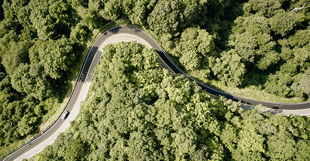
As you ride the Back of the Dragon, you'll encounter hairpin turns, switchbacks, slaloms, elevation changes, and spectacular views. Simply put, it's a fantastic motorcycle road, and should be near the top of your list of must-ride motorcycle destinations—no matter where you live.
Where does the Back of the Dragon begin and end?
The southern terminus of the Back of the Dragon is located at SR16's juncture with U.S. Highway 11 in Marion, Virginia. Follow SR16 north and you'll enter the town of Tazewell—the Back of the Dragon's northern terminus and home of the Back of the Dragon store.
How many miles is Back of the Dragon in Virginia?
The Back of the Dragon covers 32 miles across two counties and features more than 400 turns. It also climbs three mountains—Big Walker, Brushy, and Clinch—and offers breathtaking views of the surrounding mountains and the valleys below.
Back of the Dragon route map
Use our interactive Back of the Dragon route map to plan your ride. But don't feel limited to the stops we've included—this area of Virginia offers plenty of additional opportunities for rides and recreation along and beyond the Back of the Dragon.
Weather along the Back of the Dragon
Riding in the mountains of Virginia means preparing for all types of weather. To help you decide when you want to ride the Back of the Dragon—and what types of motorcycle gear and clothing you'll want to pack—here are the month-by-month averages for nearby Wytheville, Virginia.
Motorcycle safety tips
SR16 connects Tazewell to Marion and Interstate 81, which means you'll probably share the road with commercial, commuter, and tourist traffic. Throughout your ride, you'll pass through farmlands and forests, over mountains, and even alongside a lake. Keep these safety tips in mind:
Watch for loose gravel, fallen rocks, farm debris, and other surface hazards
Stay alert for wildlife crossing the road, including deer, bears, and turkeys
Expect limited sight distances along most of the route, including several blind curves
Take a moderate pace entering turns and keep your eyes on the road ahead, not the scenery.
Stops to make along the Back of the Dragon
While the Back of the Dragon is only 32 miles long, this route offers plenty to see and experience. Make the most of your ride with these two destinations:
Hungry Mother State Park
Hungry Mother State Park is a 2,900-acre park that features a 108-acre lake. The park offers camping, picnic areas, and about 18 miles of hiking trails.
Tazewell
Like other Appalachian communities that once depended on coal, Tazewell took some time to reimagine and reinvigorate itself. The roadmap to success turned out to be the Back of the Dragon. The town has rolled out the welcome mat and embraced visitors to the area. It's a wonderful thing when motorcycle riders represent the economic present and future, isn't it?
Related Links
Your motorcycle tires are all that connect you to the road—and on curvy roads like the Back of the Dragon, that connection is crucial. Are your tires ready for your next ride?
Don’t let insufficient motorcycle insurance stop you from enjoying your ride. Review Virginia’s insurance requirements and rules of the road.
The general information in this blog is for informational or entertainment purposes only. View our blog disclaimer.
*Data accuracy is subject to this article's publication date.


