The legendary Devil’s Highway motorcycle route


0 min. read
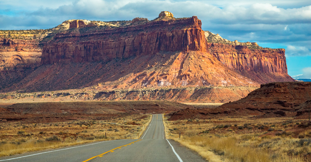
Once known as Route 666, the "Devil's Highway" in New Mexico, Colorado, and Utah was changed to Route 491 in 2003. However, the spooky reports of shapeshifters, demon dogs, and other paranormal phenomena still shroud this 200-mile stretch of highway in mystery and superstition.
Whether you embrace the mythical legends of the Devil’s Highway or not, you’re in for a unique ride through stunning, highly underrated desert landscapes. Here's what to consider before jumping on your bike and hitting the road.
Weather along the Devil’s Highway
When you ride through three southwestern states with changing elevation, you have to plan for a wide range of weather possibilities. Keep the following in mind when packing for your trip:
Hot days in your motorcycle gear can lead to heat exhaustion and dehydration. Invest in properly vented safety gear, keep extra water with you, and take frequent breaks.
In desert climates, temperatures drop steeply when the sun sets. Dress in layers and if you plan to camp, be prepared for cold nights.
Higher elevations can see snow, especially in the winter months. Watch for ice and other hazards on the road.
Dry, desert terrain is prone to flash flooding when storms come through. Mind local barricades and don’t drive through standing water.
Check out the monthly temperature averages for the southern terminus of the route—Gallup, New Mexico—for an idea of temperatures when you plan to travel.
Devil’s Highway safety tips
The US 666 designation was the original source of this highway's nickname. However, many believe that high fatality rates along the New Mexico portion are no coincidence.
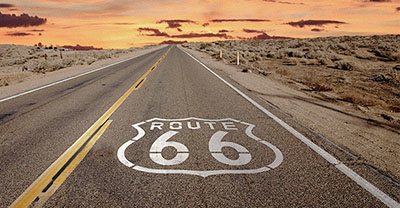
Since 1926, when the highway was named Route 666—a name it came to logically as the sixth offshoot of Route 66—drivers have reported a wide variety of spooky events. One of the most common reports is of phantom vehicles speeding toward them in the wrong lane, running them off the road, and disappearing suddenly into the night. These sightings, paired with the demonic moniker, have led to the road’s cursed reputation.
In the 1990s, the highway was listed as one of the most dangerous roads in the nation. Although rumors of paranormal causes spread, the explanation was relatively simple: the stretch north of Gallup was poorly asphalted, far too narrow, and ill-equipped to handle the traffic volume.
In recent years, several safety improvements have helped significantly decrease fatality rates. However, you still need to stay focused on the road ahead. Frequent construction, heavy commercial traffic, and unpredictable weather require riders to take extra precautions.
Keep a basic toolkit on hand and stock your emergency kit with extra food and water.
Fill your gas tank whenever possible. You can easily ride 100 miles between filling stations.
Cellphone service isn’t guaranteed, so have route notes or a paper map with you.
Thoroughly inspect your bike before you start your trip, being mindful of fluid levels, tire tread, headlights, and other maintenance essentials.
Stops to make along the Devil’s Highway
Since the Devil's Highway motorcycle route is so long—passing through three states, dozens of small towns, and two Native American Reservations—you have many opportunities for pit stops along the way. Here are some top recommendations based on the areas you'll cruise through.
Gallup, New Mexico
Gallup is a small city known for its red rock landscapes, Native American traditions, and outdoor adventure. Whether you love the arts, are a foodie, or want to explore the natural world, there are endless things to do in Gallup. If you love unique finds and have room on your bike to bring a treasure home, stop at Bill Malone Trading. Plan to stay here a night or two to take it all in.
Shiprock, New Mexico
Shiprock is a community on the Navajo reservation, named after the nearby rock formation—a site formed from volcanic rock that is sacred to the Navajo people and prominently connected to Navajo mythology. Visit this geological wonder for the stunning views and a taste of local culture.
While most people drive from Gallup to Shiprock on Hwy 491, there’s a scenic route that will take you through red rock cliffs and the forests of the Chuska Mountains. This route takes about an extra half hour but is well worth it if you have the time.
Trail of the Ancients
Trail of the Ancients Scenic Byway winds through Colorado and Utah, exploring the cultural terrain of the Ancestral Puebloan people. While this byway is a road trip all on its own, it does overlap the Devil’s Highway route in two locations in Colorado. You can follow it to the following two attractions.
Four Corners Monument
A southern branch of the byway splits from Hwy 491 into Hwy 160, leading to the Four Corners monument. This fun attraction and photo-op allows you to be in the four states of Arizona, New Mexico, Colorado, and Utah at the same time. Be prepared for heavy traffic, especially in summer months, and note that there’s a small per-person admission fee.
Mesa Verde National Park
Further east through the city of Cortez, the byway leads to Mesa Verde National Park. The park is home to a large cluster of ancestral sites and artifacts, including Cliff Palace, a stunning structure carved into the cliffside. You can take walking tours of the cliff dwellings or explore at your own pace along the many hiking trails.
Monticello, Utah
Monticello may be a small town, but it's a memorable one. Whether you're into hiking, camping, or golfing, this area ticks all the boxes. Don't miss out on a memorable hike along the Chesler Park Loop Trail or the Newspaper Rock Recreation Site— where you can see the largest known collections of petroglyphs (rock carvings).
The general information in this blog is for informational or entertainment purposes only. View our blog disclaimer.
*Data accuracy is subject to this article's publication date.


