Independence Pass: One of Colorado's most scenic motorcycle routes


0 min. read
Colorado's Rocky Mountains contain countless thrilling motorcycle routes, but few compare to Independence Pass.
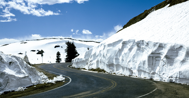
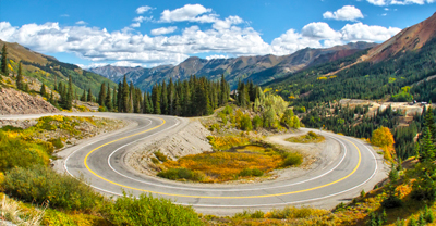
This truly iconic route is the second-highest paved pass in Colorado, traveling nearly 40 miles through mountainous terrain. It takes you through twists, turns, scenic lookouts, and a historic ghost town before reaching the summit at 12,095 feet above sea level.

Independence Pass route map
Many riders begin the Independence Pass route in Aspen, heading toward Twin Lakes. But the ride is awesome in either direction. Glenwood Springs and Leadville are ideal lodging locations if you're planning a multi-day adventure.
Always check CDOT to plan your route, especially if you plan to ride early or late in the season. Independence Pass typically opens around Memorial Day weekend and closes at the end of October. However, even in the summer, this road can be closed due to accidents, wildfires, or extreme weather conditions.
Weather along Independence Pass
When you’re riding in the summer, Independence Pass can throw a little bit of everything at you weather-wise.
You could experience snow, sunshine, and lightning storms on the same day. Storms often form without warning in the mountains, especially during the summer months. To reduce your risk of being caught in a storm, plan to reach the summit earlier in the day, and then spend the rest of the day at lower elevations.
Regardless of your starting point, you’ll likely lose service as you leave town, so check the weather conditions before you continue. If there is bad weather in the forecast, consider delaying your ride.
While the weather at the summit of Independence Pass may differ from lower-elevation towns, here’s what you can expect in nearby Aspen:
Motorcycle safety tips
This route is not for the faint of heart—it requires riding skills and confidence. Some sections turn into a single-lane road, followed by challenging or steep terrain.
You must be vigilant and aware, especially since some areas don't have guard rails or shoulders. That said, there are plenty of places among the twists and turns to pull over and take in the stunning views.
Watching your speed is imperative as you ride the Independence Pass motorcycle route. CDOT has posted advisory speeds between 10 and 30 miles per hour for the entire route. Pay attention to signage, especially when approaching turns.
While the road is closed during the winter, when avalanches are a possibility, rock slides can occur in the summer. If you ride early in the season, when the snowpack is melting, you could also ride through wet areas, as small waterfalls can flow directly onto the road. Wildlife on the road—including coyotes, mule deer, bears, and lynx—is also a possible hazard.
Lastly, pack plenty of water. Dehydration can worsen altitude sickness.
Stops to make near Independence Pass
Whether you love history, shopping, nature, or all the above, there's so much to see and do in the area surrounding Independence Pass. Here are some suggestions.
Aspen
Many riders begin their adventures in Aspen, a year-round ski resort town known for its outdoor recreation, historic landmarks, restaurants, and shops. The summit of Independence Pass is located just 19 miles east of Aspen. Depending on what direction you're coming from, Glenwood Springs, known for its natural hot springs, is also worth checking out on your way. Don't miss out on Sweet Coloradough if you have a sweet tooth.
Independence ghost town
Be sure to also stop in Independence, a preserved ghost town located 16 miles southeast of Aspen on Hwy 82. Several buildings remain in this historic mining town, including a stable, houses, a general store, and the Farwell Stamp Mill, once used to process mined ore.
Twin Lakes
There’s a reason why Twin Lakes is a popular spot for photographers—it's breathtaking. The town’s namesake pair of alpine, glacier-carved lakes are approximately 15 minutes south of Leadville and 18 miles east of the summit of Independence Pass. Here, you'll find a historic village surrounded by mountains that are over 13,000 feet high.
Leadville
This former silver mining town is home to the Leadville Historic District, which was designated a National Historic Landmark in 1961. Enjoy 70 square blocks of original Victorian architecture and 50 turn-of-the-century buildings. The town also sits at the highest altitude of any incorporated city in North America.
Leadville is an ideal home base if you plan on exploring the surrounding area after finishing the Independence Pass motorcycle route. There's no shortage of accommodations, including cabin rentals, historic hotels, B&Bs, and campsites.
The general information in this blog is for informational or entertainment purposes only. View our blog disclaimer.
*Data accuracy is subject to this article's publication date.


