Hillbilly Triangle: A Kentucky motorcycle ride you don’t want to miss
0 min. read
The Hillbilly Triangle—what an iconic name for a Kentucky motorcycle route. The mountainous backwoods roads that make up the Hillbilly Triangle form a scenic loop, with three connected communities where you can stop, refuel, and refresh throughout your ride.
Leg One: Irvine to McKee
The first leg of the triangle runs from Irvine to McKee. Head southwest toward McKee on Kentucky State Route 89 (SR89) for about 28 miles.
You’ll come to a stop sign at a T-intersection with Main Street, which is also U.S. Route 421 S. Take the opportunity to hydrate and refuel in the town center before continuing.
Leg Two: Mckee to Beattyville
The second leg of the Hillbilly Triangle runs from McKee, northeast to Beattyville. From SR89, turn left onto Main St. and ride down the road for about 3.5 miles. Bear left onto Kentucky State Route 587 (SR587) and continue northeast for 23 miles.
When you reach a stop sign at the juncture of SR587 and Kentucky State Route 11 (SR11), turn left toward Beattyville. In just under three miles, you’ll cross two forks of the Kentucky River and enter Beattyville. This is your next opportunity for food and fuel.
Leg Three: Beattyville to Irvine
The third and final leg of the triangle runs from Beattyville back to Irvine. Make a left turn from SR11 onto SR52 toward Irvine to complete the Hillbilly Triangle.
While you could start the Hillbilly Triangle route in any of the three connected cities, we suggest starting in the northernmost city, Irvine.
Best access routes to the Hillbilly Triangle
You can reach Irvine and the start of the Hillbilly Triangle from two major interstates: I-75 or I-64. Both access routes lead you conveniently to highways that are extensions of the triangle itself. Compare the routes in the descriptions below or using our interactive map.
Interstate 75 access to the Hillbilly Triangle
From Interstate 75 in Richmond, KY, take exit 90 from the northbound lane, or 90A from the southbound lane. Then take U.S. Route 25 south toward Irvine. In about four miles, you’ll reach an intersection at the juncture with State Route 52 (SR52). Make a left onto SR52 E. In 18 miles, you’ll arrive at Irvine.
Interstate 64 access to the Hillbilly Triangle
From Interstate 64 in Winchester, Kentucky, take exit 96 and turn onto State Route 627 S toward Winchester. In less than half a mile, take the second left onto N. Main St., followed by a quick left onto E. Washington St., which becomes SR89. Follow SR89 for 27 miles to Irvine, where you’ll hop on the Hillbilly Triangle.
Hillbilly Triangle route map
Our map shows the Hillbilly Triangle and two convenient ways of accessing it.
Weather conditions along your Hillbilly Triangle ride
The Hillbilly Triangle covers several counties in southeast Kentucky, and the weather can vary based on the season. It’s important to check the forecast for heat, cold, and precipitation, especially when you’re going to be riding through remote areas. Plan accordingly with this chart of local averages.
Hillbilly Triangle motorcycle safety tips
Riding your motorcycle on the Hillbilly Triangle will take you through remote parts of rural Kentucky, including the Daniel Boone National Forest. And getting to the Triangle will take you down winding backroads. Keep these safety tips in mind as you plan your ride:
Remember to buy gasoline where available, to avoid running out between gas stations.
Always carry water and snacks to keep you nourished and hydrated.
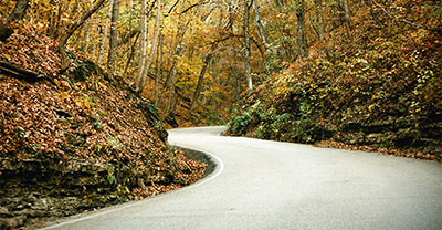
Take a relaxed pace on the back roads, enter curves at a moderate speed, and watch for wildlife and other road obstructions.
Never try to keep up with local riders. They know what lies ahead around the next curve, while you’re riding in unfamiliar territory.
Stops to make during your Hillbilly Triangle ride
Just north from Beattyville along SR11 are some sightseeing opportunities that are extra fun for motorcyclists. Read on for a few stops you can add to your adventure in southeastern Kentucky:
Natural Bridge State Resort Park
Instead of catching SR52 back to Irvine from Beattyville, continue north on SR11 about 17 miles to reach Natural Bridge State Resort Park. The park is home to an incredible natural wonder: a massive, naturally occurring stone bridge at the top of a ridge. It’s well worth the hike up the hillside and is a great opportunity to stretch your legs on a long ride.
Nada Tunnel
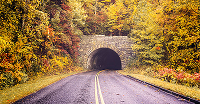
If you continue north on SR11 past Natural Bridge State Resort Park, you’ll come to a juncture with SR77. Turn right and you can ride out to and through the Nada Tunnel. This rough-hewn, one-lane tunnel was carved through the mountain between 1910 and 1912 to allow trains to haul trees harvested from the Red River Valley forest. The 12-foot wide, 13-foot high, and 900-foot long tunnel is a must-ride when visiting the area.
Eye of the Dragon motorcycle route
If you continue along SR77 and turn right onto SR715, you’ll reach the Eye of the Dragon motorcycle ride route. This route will bring you around and through the stunning Red River Gorge.
Red River Gorge
The Red River Gorge is a 13,379-acre National Archaeological District, which is listed on the National Register of Historic Places and designated as a National Natural Landmark. It’s one of the state’s most popular destinations for rock climbing and has incredible natural rock formations unique to this region of Kentucky.
The general information in this blog is for informational or entertainment purposes only. View our blog disclaimer.
*Data accuracy is subject to this article's publication date.


