Ride the Tail of the Dragon motorcycle route


0 min. read
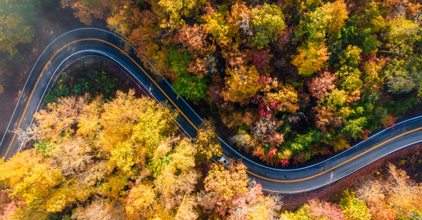
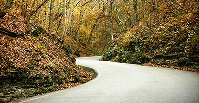
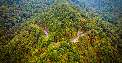
At just 11 miles long, the Tail of the Dragon may be one of the shortest popular motorcycle routes in the country, but it packs a punch with 318 thrilling curves as you ramble across the Tennessee/North Carolina border. This route offers an intense ride that demands your full attention to the pavement. It’s not a road for the squeamish, but if you're looking for a lot of excitement, don't miss this one.

It’s easy. Get your free motorcycle insurance quote!
Tail of the Dragon route map
Although the Tail of the Dragon is short, taking you from the North Carolina and Tennessee border into Tennessee, the opposite way toward Robbinsville, North Carolina, offers many route enhancements. If you're planning a multi-day road trip, be sure to make lodging reservations ahead of time.
Use this interactive map to help plan your trip.
Weather on the Tail of the Dragon motorcycle route
Weather along this route can vary greatly depending on the time of year. Avoid tackling the Dragon in winter, as the 318 turns become dangerous in snow and ice. Spring’s rainy season is also less than ideal. Summer and fall offer the best weather for a safe and enjoyable ride, though these seasons can be busy.
Review the average temperatures in Robbinsville, NC to help plan your ride time.

Request a free motorcycle insurance quote today.
Motorcycle safety tips for the Tail of the Dragon
Safety should be your top priority when riding the Tail of the Dragon. The speed limit is 30 mph, and while it’s tempting to push the limits on such a curvy road, it’s not a race. The sharp curves are thrilling, but there are anywhere from one to four deaths annually—with some years seeing as many as eight deaths.*
To stay safe on this route, avoid riding during peak traffic times. Weekends from 11 a.m. to 5 p.m. are the busiest, so aim for early mornings or late afternoons when the road is quieter. Watch for larger vehicles like tractor-trailers that may need both lanes to maneuver tight curves.
Cell service is spotty in the mountains, so bring a GPS device like SPOT or Garmin inReach. These tools can share your location with family and friends and offer an SOS feature that connects you to emergency services, even without cell phone service—a vital resource if you’re riding alone.
Where to explore after riding the Tail of the Dragon
The region surrounding the Tail of the Dragon is home to Class IV whitewater rapids, pristine trout streams, mountain trails, and crystal clear lakes. Extend your visit to experience the local mountain culture, explore nearby scenic routes, or attend local festivities like the annual Graham County 2024 Heritage Festival.
Deals Gap Motorcycle Resort (NC)
A key gathering spot for motorcyclists tackling the Tail of the Dragon, this resort features a famous Tree of Shame adorned with broken bike parts from unfortunate rides. It’s a fun, biker-centric atmosphere with amenities and lodging, perfect for connecting with other riders.
Cheoah Dam (NC)
Cheoah Dam, built in 1919 on the Little Tennessee River in North Carolina, generates hydroelectric power and forms the Cheoah Reservoir. The dam is featured in the movie “The Fugitive,” in which Harrison Ford jumps from the dam to evade capture.
Fontana Dam (NC)
At 480 feet tall, Fontana Dam is the highest hydroelectric dam east of the Rockies. It offers scenic views of the Great Smoky Mountains and Fontana Lake, making it a perfect stop for history buffs or those interested in engineering feats. There are also hiking trails and picnic spots around the dam.
Cherohala Skyway (NC/TN)
The Cherohala Skyway’s 43-mile scenic byway offers mountain views, higher elevations, and a relaxed ride that takes you to Tellico Plains, TN. Riders love the peaceful, less trafficked roads and the panoramic vistas of the Cherokee and Nantahala National Forests. If you’re staying in Robbinsville, NC, the starting point is less than 30 miles away.
Santeetlah Lake (NC)
Located in the Nantahala National Forest, Santeetlah Lake offers fishing, camping, and beach relaxation. The lakeside town has vacation rentals, including historic cabins. With over 250 miles of trails nearby, it's an ideal home base for hikers.
Joyce Kilmer National Forest (NC)
A pristine old-growth forest named after the famous poet, Joyce Kilmer National Forest is home to towering trees including massive tulip poplars, white pines, and other ancient varietals—making it the perfect setting for a laid-back picnic.
Robbinsville (NC)
A charming town that serves as a great home base for your trip, Robbinsville offers plenty of parks, eateries, and opportunity for outdoor activities. Check the local events calendar to see what's happening during your visit.
Don’t forget to prepare for your ride
Are you fully prepared for this iconic thrill-ride? Before hitting the throttle on this adventure, make sure you:
Perform routine maintenance: Give your bike a thorough inspection to ensure it's in top condition to conquer the curves.
Dress for the weather: Check the forecast and wear appropriate clothing to stay comfortable throughout your ride, especially if you get caught in the rain.
Prioritize safety: Helmets are required in North Carolina and Tennessee. Make sure to pack all your essential safety gear.
Review your insurance: Confirm that your insurance coverage is adequate for your planned adventure.

Get your free motorcycle insurance quote.
Related resources
The general information in this blog is for informational or entertainment purposes only. View our blog disclaimer.
*Data accuracy is subject to this article's publication date.


