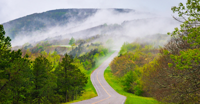
Take a breathtaking ride on the Talimena Scenic Byway


0 min. read
Embark on a journey along the Talimena Scenic Byway, consistently rated among the nation's most scenic drives. Designated a National Scenic Byway in 2005, this 54-mile route winds between Talihina, Oklahoma, and Mena, Arkansas. Its playful name hints at its origin points.
Thrillingly, the Talimena byway traverses one of the highest mountain ranges between the Appalachians and the Rockies, offering vistas comparable to the renowned Blue Ridge Parkway in North Carolina.
Planning your Talimena adventure
A haven for motorcyclists, the route snakes along the crests of Rich Mountain, boasting the Ouachita National Forest's peak elevation of 2,681 feet, and Winding Stair Mountain. For a westward-to-eastward trek, begin in Talihina at the intersection of Highways 1 and 271. As you head east, the initial two-thirds of the Talimena Scenic Byway traverse Oklahoma before seamlessly transitioning onto State Highway 88 in western Arkansas.
Talimena Scenic Byway route map
You can complete this route in about an hour—but why rush? You’ll wind your way through the Ouachita Mountains, featuring panoramic views of forested ridges, valleys, and distant lakes. There are plenty of lodging and dining options located nearby, making it convenient for a day trip or a longer motorcycle adventure.
Start planning your Talimena adventure with this interactive route map.
Weather conditions in the mountains
For optimal riding conditions, consider a summer visit. Spring can bring unpredictable weather, while fall–despite its undeniable beauty–attracts larger crowds that may slow your progress and potentially diminish the enjoyment of the ride.
Peak season is between March and October. To help you plan and pack, here's a look at Mena's average seasonal weather conditions:
Spring (March–May):

This time of year brings good cruising weather with temperatures ranging from the low 40s to the mid-70s. Plan for potential spring showers.
Summer (June–August):

Summer boasts ideal riding conditions for leisurely sightseeing. Enjoy highs reaching the upper 80s and typically clear skies.
Fall (September–November):

The route explodes with vibrant fall foliage, but be prepared for cooler temperatures and, fallen leaves hazards, and potentially more traffic.
Winter (December–February):

Colder temperatures and potential for snow and ice make this the least popular riding season. Some route sections may also be closed due to snow and ice.

It’s simple. Start with a free motorcycle insurance quote.
Safety first
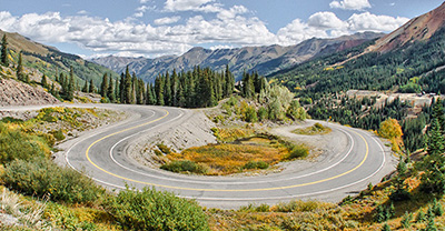
The Talimena Scenic Byway offers stunning scenery but demands respect. Ensure you’re confident in your motorcycle handling skills before hitting the road, as the byway features steep 13% grades, sharp curves, and numerous switchbacks.
Check your bike's condition before setting off, including brakes, tires, and fluid levels
There are no gas stations along the Talimena byway. Plan to top off your tank in either Talihina or Mena before beginning your trek
Drive slowly and stay alert, especially around blind corners
Be aware of weather conditions, as fog and rain can significantly impair visibility on the byway—making the road slippery with reduced traction
Watch for wildlife crossings, such as deer, bear, and snakes throughout this scenic route
Unforgettable stops along Talimena Scenic Byway
The Talimena Scenic Byway empowers you to curate your own adventure. Over 20 scenic overlooks punctuate the landscape, each revealing breathtaking panoramas.
Consider incorporating iconic overlooks like Panorama Vista, Sunset Point Vista, Shawnee Vista, and Grandview Vista into your itinerary.
For a historical and natural immersion, venture into Queen Wilhelmina State Park atop Arkansas' Rich Mountain. This park features a Victorian resort honoring the Queen of the Netherlands. Alternatively, explore the legendary Horse Thief Springs in eastern Oklahoma and delve into its tales of outlaws frequenting this supposed watering hole.
Don’t let the ride end!
You’re in the mountains—plan some extra time to soak in the view. Enjoy further adventure at these nearby treasures:
Talimena State Park: Marking the Talimena Scenic Byway's western entrance, this park offers hiking and backpacking trails, picnic areas, and impressive views of the Ouachita Mountains.
Ouachita National Forest: Encompassing a vast 1.8 million acres, much of it bordering the Scenic Byway, this national forest offers an exceptional ride for those seeking challenging roads and natural beauty.
Cedar Lake Recreation Area: Nestled within the Ouachita National Forest and easily accessible from the motorcycle route, this recreation area provides a perfect place to unwind after your ride.

Request your motorcycle insurance quote today.
The general information in this blog is for informational or entertainment purposes only. View our blog disclaimer.
*Data accuracy is subject to this article's publication date.


