Ride the Pig Trail Scenic Byway


0 min. read
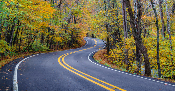
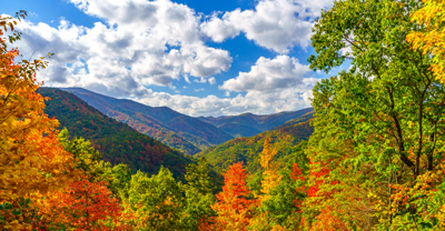
The Pig Trail Scenic Byway weaves through Arkansas’ Boston Mountains. The 19-mile stretch was designated as a scenic byway in 1989. Historical reports of freely wandering wild and domestic pigs in the area and the twists and curves of the trail that resemble a pig’s tail are possible origins of the name. It's a beautiful region at the highest section of the Ozarks, where you can immerse yourself in the dense forests and scenic overlooks of Ozark National Forest.
Pig Trail Scenic Byway route map
The relatively short route can easily be completed in an afternoon—an hour or two if you make a couple of stops. Alternatively, you could plan a multi-day trip—exploring each point of interest along the byway and the surrounding towns. Explore the options with our Pig Trail route guide.
You’ll find the southern terminus of the Pig Trail Scenic Byway in the southeast corner of the Ozark National Forest—close to I-40. The byway continues north for 19 miles and ends in the community of Brashears where it runs into US Highway 16.
Weather along the Pig Trail Scenic Byway
The overall climate in Ozark, Arkansas, includes hot summers and mild, sometimes cold winters. Consider the monthly high and low temperature averages below as you plan your trip.
Keep an eye on the weather forecast before you start your ride. Riding a motorcycle in the rain can be dangerous on flat roads, not to mention the steep and crooked roads of the Pig Trail.
Motorcycle safety tips
The qualities that make the Pig Trail so exciting and beautiful also present safety hazards. This route has a lot of sharp curves and steep inclines that can surprise even seasoned riders. Here are some safety tips to keep in mind:
Ride at a safe speed. Take this route cautiously. Pay attention to the frequent speed limit signs directing you to adjust your speed for the terrain.
Be aware of the altitude. If you're not accustomed to high altitudes, monitor yourself for potential symptoms like dizziness or shortness of breath.
Be prepared for the unexpected. The sharp turns and thick forest can make quick reaction times necessary. Stay alert, leave more following distance, and check the trees for emerging animals.
Use caution in foggy, wet, or slippery conditions, and adjust your riding style accordingly.
Check that your motorcycle is in good working condition before you head out. Examine your tires, fill up with gas, test your battery, and refresh your safety kit, as it can be difficult for assistance to reach you. Check that your lights are working, especially if you could end up riding in the dark.
Things to do along the Pig Trail Scenic Byway
This short route is packed with natural wonders to stop and enjoy, and the surrounding area features other scenic byways, convenient food and lodging, and hiking trails.
Stop at Turner Bend Store
The Turner Bend Store has served as a local hub for more than 100 years. This spot has everything an adventurer needs, from campsites and restrooms to boat rentals and recreation shuttles—plus a deli that makes fresh sandwiches. You can also purchase Pig Trail merchandise as a memento of your ride.
Discover natural wonders
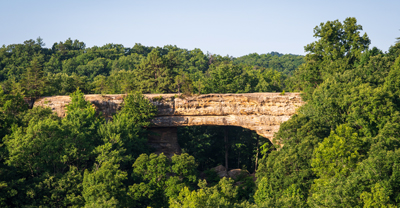
The Pig Trail is unique because it’s relatively undeveloped, offering a glimpse into the past. You'll enjoy scenic views as you ride through the Ozarks, without a ton of modern distractions. You can find guided tours, fly-fishing spots, hiking trails, scenic overlooks, waterfalls, and much more. For a fun hike and photo op, check out Hanging Rock, the Ozark Scenic Overlook, or Pig Trail Falls on our route map.
Visit Fayetteville
If you're planning an extended stay and ride, stop in Fayetteville for a night or two. Arkansas' second-largest city is known for its arts, outdoor recreation, and charm.
Check out the Fayetteville Farmers Market if you're in the city on a Saturday. This year-round market has been open since 1973, offering everything from homegrown produce, eggs, and meat to local artisans and musicians.
Neighboring scenic byways
You can find a dozen nationally designated scenic byways in Arkansas, which are all worthy contenders for a road trip. But three of these awesome rides are right next door to the Pig Trail.
If you’re looking to extend your travels in northwestern Arkansas, you can head south to the Mt. Magazine Scenic Byway, east to the Ozark Highlands Scenic Byway, or northwest to the Boston Mountains Scenic Loop.
La información general contenida en este blog tiene únicamente fines informativos o de entretenimiento. Vea el descargo de responsabilidad de nuestro blog.
*La exactitud de los datos está sujeta a la fecha de publicación de este artículo.


